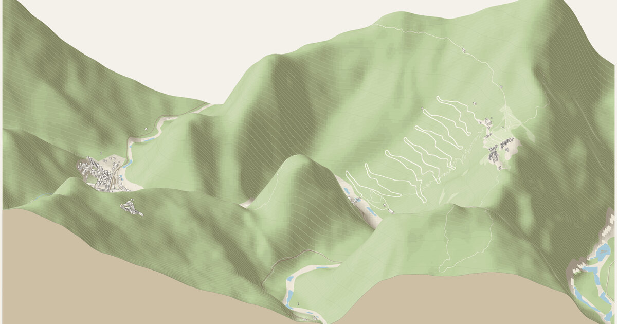
Machu Picchu and Aguas Calientes — Peru. A frame 3.8 km across and 2.4 km deep (9.12 km²), centered on 13.1585°S, 72.5352°W.
Camera how the camera works →
Looking south-southeast (bearing 155°), a fixed bearing with no snapping. Orthographic, tilted 30° down from the horizon: ground running into the picture is drawn at 0.5× its length and heights at 0.87×. 1.6 px per meter across the frame; the whole drawing is 6,128 × 3,472 px at 1:1.
Sources where the data comes from →
- OpenStreetMap: 1,110 features read from the cached download.
- Copernicus DEM GLO-30 elevation (Worldwide (European Space Agency, Copernicus program); a 30 m surface model from the TanDEM-X radar mission: it includes forest canopy and buildings, so it suits mountains better than cities), fetched at 10 m per pixel and resampled to a 10 m grid. The ground runs from 1858.6 m to 2934.0 m above sea level (1075.4 m of relief), drawn 1× taller than life. Buildings and bridges keep their true heights.
Ground what the ground is made of →
From the map, 73 mapped areas of water, islands, parks, woods and other cover, and 274 ribbons of road, path, rail, canal and weir. Painted in 120 strips from back to front, 20 m deep each, so hills hide what is behind them (why). Contours every 20 m with every 5th line heavier: 51,060 segments.
Rivers and rapids how rapids are read →
No stretch of water read as rapids: places where the river’s surface, recovered from the lidar, falls faster than 0 m per 100 m, measured over 40 m. Rock standing more than 1 m clear of that surface is drawn as boulders. Both are inferred from the lidar, not observed.
Buildings where heights come from →
567 buildings, extruded from footprints of at least 12 m² that lie wholly inside the frame, from OpenStreetMap.
- 2 (0%) from a
heighttag - 2 (0%) from the number of floors, at 3.4 m a floor
- 563 (99%) guessed from the building’s type and size
Bridges how decks are placed →
23 bridge spans of up to 22 m, so long bridges sort among the buildings. Deck heights are rules of thumb: every bridge 7 m per OSM layer.
Drawing paint order →
The paper palette, dots on roof corners only, on a ground slab 14 m thick.
This build the archive →
Built November 15, 2026 in 0.8 s, 4.61 MB of SVG. From commit eac0b4d, “Machu Picchu: wide frame across the Urubamba, town and citadel side by side”.
Map data © OpenStreetMap contributors (ODbL) · Elevation: produced using Copernicus WorldDEM-30 © DLR e.V. 2010-2014 and © Airbus Defence and Space GmbH 2014-2018 provided under COPERNICUS by the European Union and ESA; all rights reserved (Licence for the use of the Copernicus WorldDEM-30 (free, worldwide, commercial use allowed)) · credits and licenses