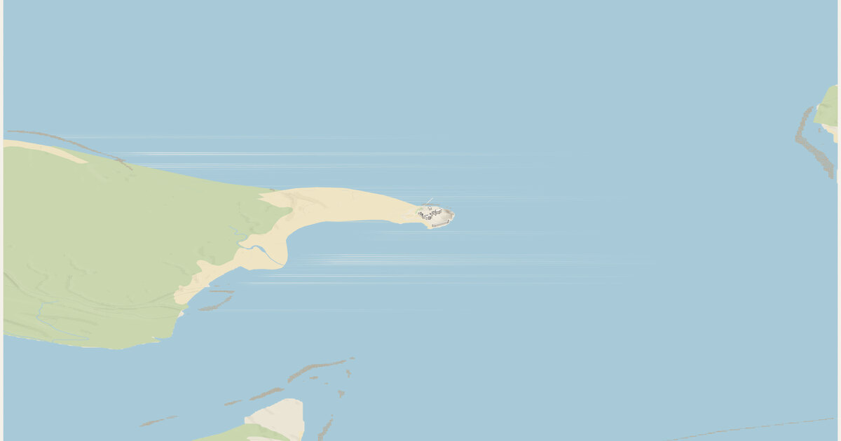
Fort Sumter — Charleston Harbor, South Carolina. A frame 3 km across and 3.9 km deep (11.70 km²), centered on 32.7521°N, 79.8751°W.
Camera how the camera works →
Looking north-northwest (bearing 332°), turned 28.2° counter-clockwise from the configured 0° so the street grid runs along the diagonals. Orthographic, tilted 30° down from the horizon: ground running into the picture is drawn at 0.5× its length and heights at 0.87×. 2 px per meter across the frame; the whole drawing is 6,048 × 3,984 px at 1:1.
Sources where the data comes from →
- OpenStreetMap: 797 features read from the cached download; the sea and tidal water come from 14 coastline ways.
- USGS 3DEP elevation (United States (U.S. Geological Survey); bare-earth lidar, 1 m across most of the US, served by the National Map), fetched at 3 m per pixel and resampled to a 6 m grid. The ground runs from -1.5 m to 7.0 m above sea level (8.5 m of relief), drawn 2× taller than life. Buildings and bridges keep their true heights.
Ground what the ground is made of →
From the map, 23 mapped areas of water, islands, parks, woods and other cover, and 14 ribbons of road, path, rail, canal and weir. Painted in 325 strips from back to front, 12 m deep each, so hills hide what is behind them (why). Contours every 5 m with every 5th line heavier: 736 segments.
Rivers and rapids how rapids are read →
No stretch of water read as rapids: places where the river’s surface, recovered from the lidar, falls faster than 0 m per 100 m, measured over 40 m. Rock standing more than 1 m clear of that surface is drawn as boulders. Both are inferred from the lidar, not observed.
Buildings where heights come from →
10 buildings, extruded from footprints of at least 12 m² that lie wholly inside the frame, from OpenStreetMap.
- 10 (100%) from a
heighttag - 0 (0%) from the number of floors, at 3.4 m a floor
- 0 (0%) guessed from the building’s type and size
Bridges how decks are placed →
No bridges in the frame.
Drawing paint order →
The paper palette, a dot on every visible corner, on a ground slab 20 m thick.
This build the archive →
Built November 14, 2026 in 1.2 s, 0.49 MB of SVG. From commit f768bb1, “Launch prep: MIT license, map licenses, 'Make your own' README, shop links in the explorer”.
Map data © OpenStreetMap contributors (ODbL) · Elevation: USGS 3DEP (public domain) · credits and licenses